
Walk the St. Johns County Street Directory
A reliable street search separates ownership from occupancy. The St. Johns County Property Appraiser Search accepts an address or address range and returns the parcel key needed elsewhere. The map then shows nearby lots. Landmark connects the parcel or legal description to recorded instruments. Permits date work at the site. Voter information and old directories may support residence at a point in time, yet both have gaps and privacy limits.
- Enter the street address, or a segment such as 1200-1299 Main, in the Property Appraiser search. Save the parcel ID, site address, tax mailing address, legal description, and owner name.
- Open SJCPA Search Maps. Find the parcel, inspect its shape, and click the lots beside it rather than assuming sequential numbers identify every adjoining parcel.
- Use parcel ID, legal description, or owner name in the Clerk's Landmark index. Follow deed parties and book/page or instrument references.
- Search county permits by address or parcel. Read the work and inspection dates as building evidence, not proof of who occupied the home.
- For registered presence, verify an individual through VoteSJC or obtain a lawful redacted voter extract. For earlier households, consult verified directory editions and Historical Society street files.
This order keeps unlike facts apart. A parcel roll identifies a tax owner. A deed records a conveyance. A voter record reflects one registration. A directory entry records what its publisher gathered. Together they can support a careful street-by-street account, but one result alone cannot name a full household.
Search St. Johns County Street Records
The Property Appraiser is the strongest modern starting point for a St. Johns County street directory search. It is free, requires no account, and supports both a single site and a street segment. Its CAMA data, meaning the county's computer-assisted mass appraisal roll, can also be downloaded. Current and historical files list owner, site and mailing addresses, land use, legal description, values, sales, and building details.
| Search choice | Input | Useful result |
|---|---|---|
| Owner Name | Text, with optional exact match | Parcels associated with the entered owner |
| Location Address | Single address or street range | Site parcels along a St. Johns County street |
| Parcel Number | Parcel identifier | One stable tax-roll record |
| Legal Information | Subdivision or legal terms | Land tied to a recorded description |
Read the site and mailing lines separately. Site, also called situs, identifies the property. Mailing identifies where tax notices go. Different values can point to an absentee owner, an agent, or a post-office box. They do not prove who sleeps at the site. Homestead status can support a primary-home conclusion, but it is not a household roll.
Map St. Johns County Streets
SJCPA Search Maps changes the task from text matching to spatial browsing. Search for an address, parcel, street, park, school, fire station, or golf course. Then zoom and pan across parcel outlines. Layer toggles add zoning, ZIP, school, commission, evacuation, future-land-use, and current or historic aerial context. The parcel-click tool supplies property information for the lot beneath the pointer.
Map one block at a time. Click the subject parcel, both touching lots, and each parcel across the road only when the research question includes them. Curved roads, corner lots, easements, and large tracts make house-number order unreliable. The free county GIS downloads provide parcels, subdivision data, easements, PLSS survey framework, and tax districts for deeper civic or family research. Printed output does not turn an approximate line into a survey.
The county Neighborhood Bill of Rights page adds registered organization and boundary context after the parcel map defines the street.
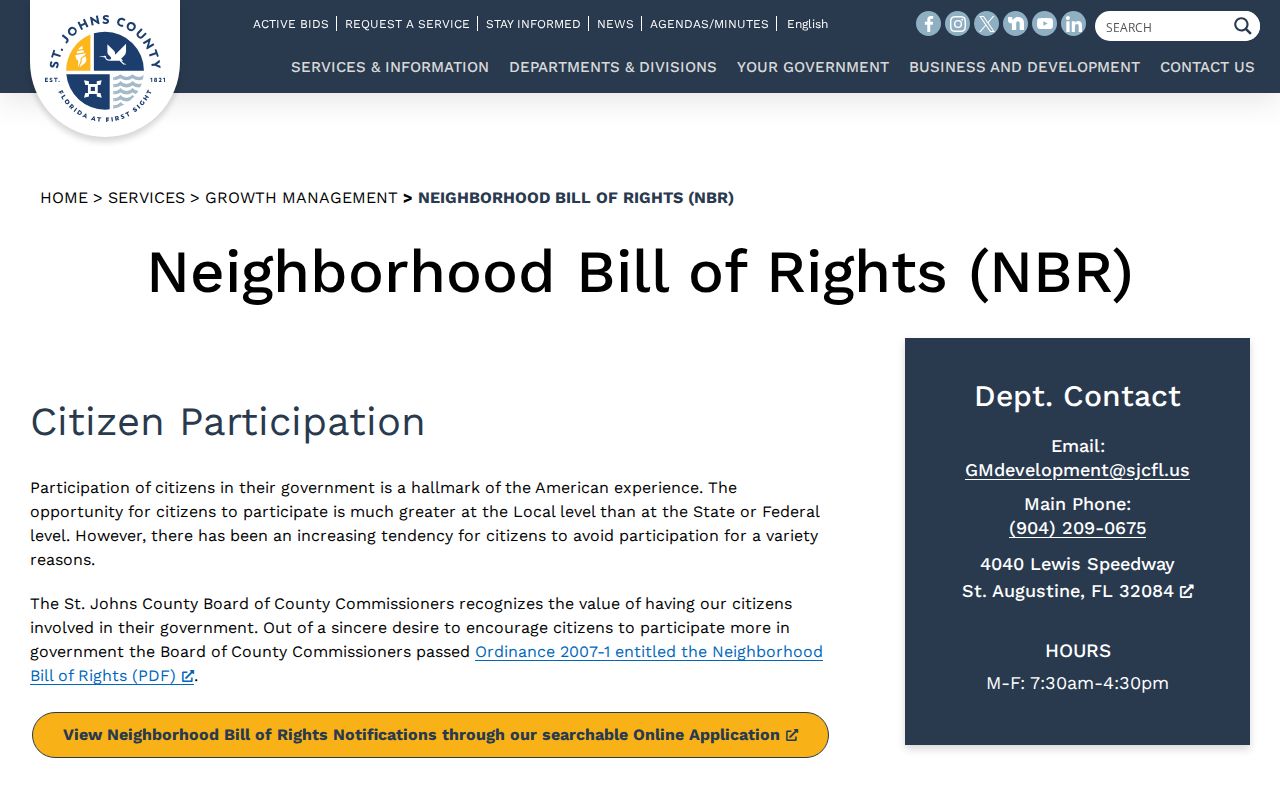
The registry supplies organization contacts and community geography, not a list of members or residents along the street.
- Parcel
- A tax and mapping unit with its own identifier. One street address can involve more than one parcel.
- Situs address
- The physical site address, distinct from the tax owner's mailing address.
- Plat
- A recorded map that divides land into lots, blocks, roads, and easements.
- Criss-cross directory
- A directory arranged by street or address rather than only by surname.
St. Johns County Street Permits
The county permit search can date additions, roofs, demolition, utilities, pools, and other work. Address and parcel fields are optional, as are permit type, project name, permit number, contractor, proposed use, and date range. Results can lead to inspections, holds, power releases, certificates of occupancy, and issued permits. An owner, applicant, or contractor shown there is connected to the project, not necessarily to residence.
The county's permit screen shows how much detail can be entered before a search.
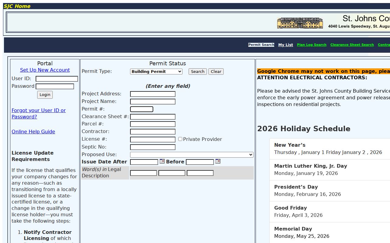
The form is most effective after the street directory search has supplied a parcel number and a likely year range.
The separate St. Johns County Plan Log accepts project address, parcel number, permit number, clearance sheet, contractor, fire house ID, and date. Its review chronology may explain when a structure or improvement entered the county process. For underlying plans or code files, contact Building Records at 904-827-6822 or publicrecordsbldg@sjcfl.us. That request channel matters when the public search returns only a summary.
The Plan Log provides a second address-based route when a permit number is not known.
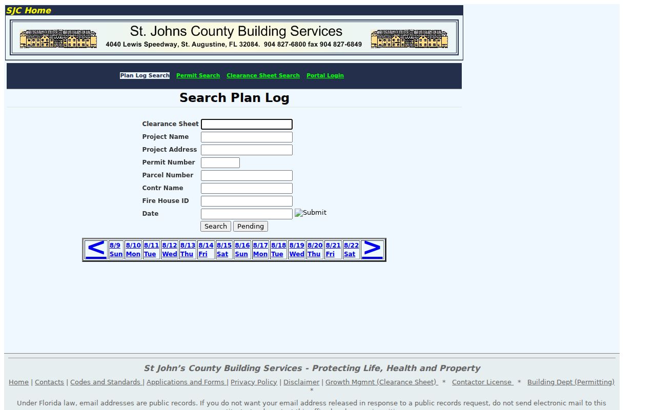
Its dated application and review events help establish a property timeline without turning project contacts into residents.
St. Johns County Street Directory Sources
No single St. Johns County street directory covers owners, registered voters, construction, instruments, and past adults. The best record depends on the fact sought. Online tools serve current research, while terminals, written requests, libraries, and archives fill gaps.
| Record Set | Keeper | What It Shows | Access |
|---|---|---|---|
| Property tax roll | St. Johns County Property Appraiser | Owner, site and mailing address, use, legal, values | Free search and CAMA download; office or request fallback |
| GIS parcel map | Property Appraiser GIS | Lot geometry, nearby parcels, zoning, ZIP and aerials | Free viewer and GIS downloads |
| Recorded instruments | Clerk Recording Division | Deeds, mortgages, liens, plats, dates and parties | Landmark; terminal; email, mail or in-person request |
| Voter registration | Supervisor of Elections | Registration residence and status for a named voter | Individual verification or redacted physical-media extract |
| Permits and plans | St. Johns County Building Department | Project, applicant, contractor, inspections and work dates | WATS/Plan Log, department counter, phone or email request |
| Historical directories | Historical Society and SJCPLS | Named adults, work, house or boarding clues | Digitized volumes, catalog, branch databases, appointment |
The parcel number and legal description are the safest links between the roll, map, deed, and permit files. Names and numbers can change. For older St. Augustine addresses, a legal description, plat, Sanborn map, or Historical Society street file can bridge the gap. The research found no authoritative countywide renumbering date, so none should be assumed.
Link St. Johns County Street Deeds
The Clerk's Landmark Official Records index is not an address roster. Use the parcel or legal text found in the street search, then inspect instruments tied to that land. Landmark offers name, document, case number, book/page, consideration, parcel ID, record date, Clerk File Number, and legal-description modes. A name search also supports direct and reverse party logic, match type, book type, document category, and date limits.
A deed result can show indexed parties and roles, document type, recording date, instrument number, Official Records book/page, consideration, parcel ID, legal description, and a released image. Read the image because indexing can be wrong. The portal's 1775 shortcut is only a form boundary, not proof that each series is complete from that date. When a street directory trail reaches uncertain coverage, use the public terminals at 4010 Lewis Speedway or request a record by email, mail, or hand delivery.
Free viewing and certified proof are different products. Ordinary copies cost $1 per page, with $2 certification; e-certification adds a $6 service charge per document. Call Recording at 904-819-3600 or email Recording@stjohnsclerk.com to confirm the available series and copy route.
Registered Presence on St. Johns Streets
VoteSJC verifies an individual voter. It is not documented as a public street-browse tool. Florida's public voter fields generally include name, residence address, birth date, party, phone, email, registration status, and participation history. Ballot choices are never disclosed. Social Security numbers, driver-license or state-ID numbers, application source, copied signatures, preregistrants, and protected addresses remain limited under section 97.0585, Florida Statutes.
A countywide street study requires the lawful active/inactive extract. The state supplies it on physical media by mail or pickup, not by email or an open web screen. Protected data must be removed. Registration proves an election record at a stated address and time. It does not capture children, nonregistered adults, or everyone who has recently moved.
Note: An inactive registration can remain eligible, so status and participation dates must be read before drawing a present-day conclusion.
Read Historic St. Johns Streets
Early St. Augustine entries often use a street, a corner, or the word “near” instead of a modern house number. The verified 1880 Chapin directory distinguishes a house from boarding and can add an occupation or employer. The 1904 guide-directory offers a second known point, but the complete printed run is not published in an authoritative shelf list. Ask the St. Augustine Historical Society or county library for the exact target year.
The Historical Society keeps exact-street vertical files with clippings, reports, and maps. Its St. Augustine Sanborn companion maps cover nine editions from 1884 through 1946. Those tools stabilize old geography. Full collection and entry-reading details belong on the St. Johns County city directory page; here they serve only as the older address layer.
St. Augustine's colonial core, Lincolnville, and the Spanish Quarter often reward this map-and-street method. Hastings has separate 1921 and 1930 Sanborn sets. Newer areas such as Nocatee and World Golf Village rely more on parcel, plat, permit, and association geography.
St. Johns Recording Alerts
The Clerk reported 19,158 deeds and 11,700 Recording Activity Notification enrollees for 2025. That volume explains why a street record should always be read with its date and instrument type. The free Recording Activity Notification service emails when an Official Record matches a monitored personal or business name. It does not block a filing or prove fraud.
Register spelling variants. If an alert arrives, use its Clerk File Number or book/page to inspect the image, then contact the Clerk and law enforcement when the document appears suspicious. An alert is a useful seller-verification and personal-safety tool, not a live street directory.
Limits of St. Johns Street Records
A St. Johns County street directory cannot supply a complete resident list. Deeds and CAMA name owners, not renters or household members. Permit records name people tied to work. Association registries show boundaries and public contacts, not members. Voter files omit nonvoters and shield protected registrations. Motor-vehicle address data is restricted by federal law, and sealed records remain unavailable.
Commercial compilations may merge old and current details, confuse people with the same name, and lose source dates. Official rolls are stronger because they identify a custodian and correction path, but they also lag and can contain errors. Confirm two independent facts, such as parcel plus legal description or name plus dated instrument, before treating records as one person's trail.
Lawful use. Use St. Johns County address records for lawful family, property, civic, and safety research. Never use a street search to stalk, harass, intimidate, or harm anyone.