
St. Johns County Block Sources
A block lookup combines sources with different jobs. The map defines proximity. Property data names title holders and distinguishes a site address from the mailing address used for tax notices. A voter extract records registered presence at a past update point. Permits describe work, and civic registries identify organized areas. None is a complete resident roster.
| Local source | Block evidence | How to reach it |
|---|---|---|
| Property Appraiser iMap and CAMA | Parcel adjacency, geometry, owner, site and mailing addresses | Free viewers; downloadable GIS and CAMA data |
| State voter extract | Active and inactive registered presence, subject to redaction | Monthly physical media by mail or pickup |
| Permit and plan records | Project, applicant, contractor, inspection, and building chronology | WATS and Building Department records request |
| Neighborhood registries | Organization boundary and public contact | City council links and county registry |
| Historical street files | Prior named-adult and address clues for available years | Historical Society and library collections |
Compare every result to its as-of date. An owner may live elsewhere. A matching mailing and site address or homestead notation supports, but does not prove, owner occupancy. A registered voter is not the full household, and protected voters may be absent. Children, renters, informal household members, recent arrivals, and people who do not register to vote will not appear consistently.
Map St. Johns County Neighbors
The St. Johns County Property Appraiser Search Maps accepts an address, parcel, street, park, school, fire station, or golf course. Search the subject address, zoom until parcel outlines are clear, and click the subject polygon. Then click each touching polygon. Only cross the street when the question defines those lots as neighboring. No official radius or buffer tool was verified, so do not claim one.
- Find the subject parcel and note its parcel ID, legal description, and site address.
- Click each adjoining polygon and record the owner and mailing address with the record date.
- Open the tax record for each parcel. Keep owner, mail recipient, and possible occupant as separate labels.
- Use zoning, ZIP, school, evacuation, future land use, and current or historic aerial layers when the question needs context.
- For every parcel along a full named road, move to the St. Johns County street directory workflow.
Advanced research can use the county's free geodatabase or shapefile downloads to select adjoining polygons. The same caution applies: GIS geometry returns parcels and owners, not a list of renters or households.
Owners Are Not All Neighbors
The Property Appraiser Search includes parcel ID, owner, mailing and site addresses, legal description, use, value, sales, exemptions, building traits, and land facts. Those fields answer title and tax questions. A deed proves a conveyance. It does not prove that a named buyer moved into the building.
Permits can place an owner, applicant, or contractor in a project record without making that person an occupant. Association contacts represent organizations, not every home. Treat each source as a narrow observation. If the goal is simply to greet someone next door, direct and respectful contact is better than guessing from an owner roll.
Parcel versus social neighbor. A touching lot is a geographic neighbor. Community ties may cross streets, water, subdivision lines, or association boundaries.
Registered Presence on St. Johns Blocks
The individual VoteSJC lookup verifies one registration; it is not a street-browse tool. For lawful block analysis, Florida's Division of Elections provides a monthly active and inactive voter extract. The extract arrives on physical media by mail or pickup, not by email or a public web browser. Requests require contact details and must reach the state at least 24 hours before monthly availability; standing requests expire at year end.
Section 97.0585, Florida Statutes, generally makes name, residence address, date of birth, party, phone, email, registration status, and participation history public. Social Security, driver-license or state-ID numbers, application source, preregistrant details, and copied signatures are protected. Address Confidentiality Program participants and other exempt voters require added shielding. Voting history reports participation, never ballot choice.
The state voter extract request page shows the delivery route.
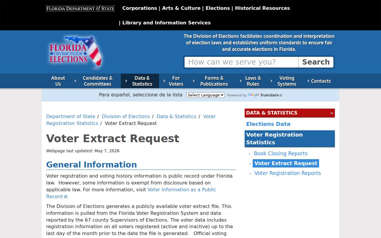
This source supports a dated, redacted count of registered presence, not a claim about every current occupant.
Florida's public voter-field guidance explains which details are open.
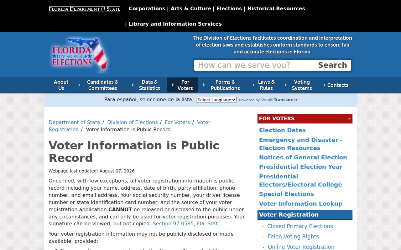
The distinction keeps protected identifiers and ballot secrecy outside a block search.
St. Augustine Neighborhood Contacts
The independent Neighborhood Council, formed in 2003, connects organized city neighborhoods. Verified areas are Flagler's Model Land, Fullerwood, Lighthouse Park, Lincolnville, Magnolia, Nelmar Terrace, North Davis Shores, Old City, South Davis Shores, Spanish Quarter, and Uptown. These names identify civic context around an address, but a neighborhood boundary is not the same as a parcel line.
Neighborhood Council
Links the eleven verified St. Augustine neighborhood associations and their public civic work.
County Registry
The Neighborhood Bill of Rights and RARA records identify registered groups, boundaries, and contacts.
Local History Help
The St. Augustine Historical Society's street-arranged files help with older blocks and vague early addresses.
No public resident roster was found for these organizations. A listed officer or contact speaks for a group in a civic role; that record does not reveal members or every person inside the boundary.
Recover Earlier St. Johns Neighbors
A verified St. Augustine directory edition can reconstruct named adults near an address for that year. The 1880 and 1904 volumes are known time points, not a complete run. Street-arranged Historical Society files, Sanborn maps, census schedules through 1950, plats, and historic aerials can hold the geography steady as names change. An old directory may omit children and other residents, while a census is only a dated enumeration.
Start with one securely placed house. Read nearby directory entries or census households, compare adjacent names, and confirm the street on a period map. If an address number does not fit, bridge it with legal description and historic maps; no verified countywide renumbering year supports a shortcut. Ask Society staff for a target street and date rather than assuming a reverse directory survives for every year.
Note: Historic block research names people recorded in a specific source, not everyone who lived nearby.
Official St. Johns Safety Sources
Safety databases answer narrow status questions. They are not neighbor directories, and a result should never be stretched into a claim about all people at an address. The county jail page was temporarily unavailable during research. When it fails, call booking at 904-209-3125 or records and corrections at 904-810-6610, then use the court docket for the actual case progress and disposition. Arrest is not guilt.
The St. Johns County Sheriff's inmate search is the proper county source when available.
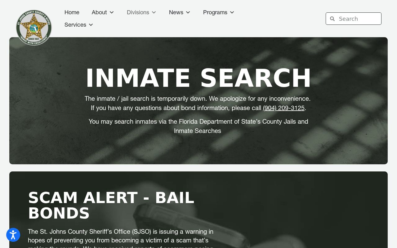
The captured page shows why a phone and records fallback matters during an outage.
For state custody or supervision, use the Florida Department of Corrections search.
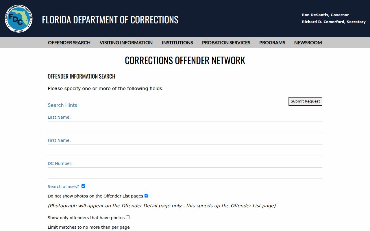
A state record does not establish a person's present local residence.
The FDLE offender registry offers statutory name and geographic searches.
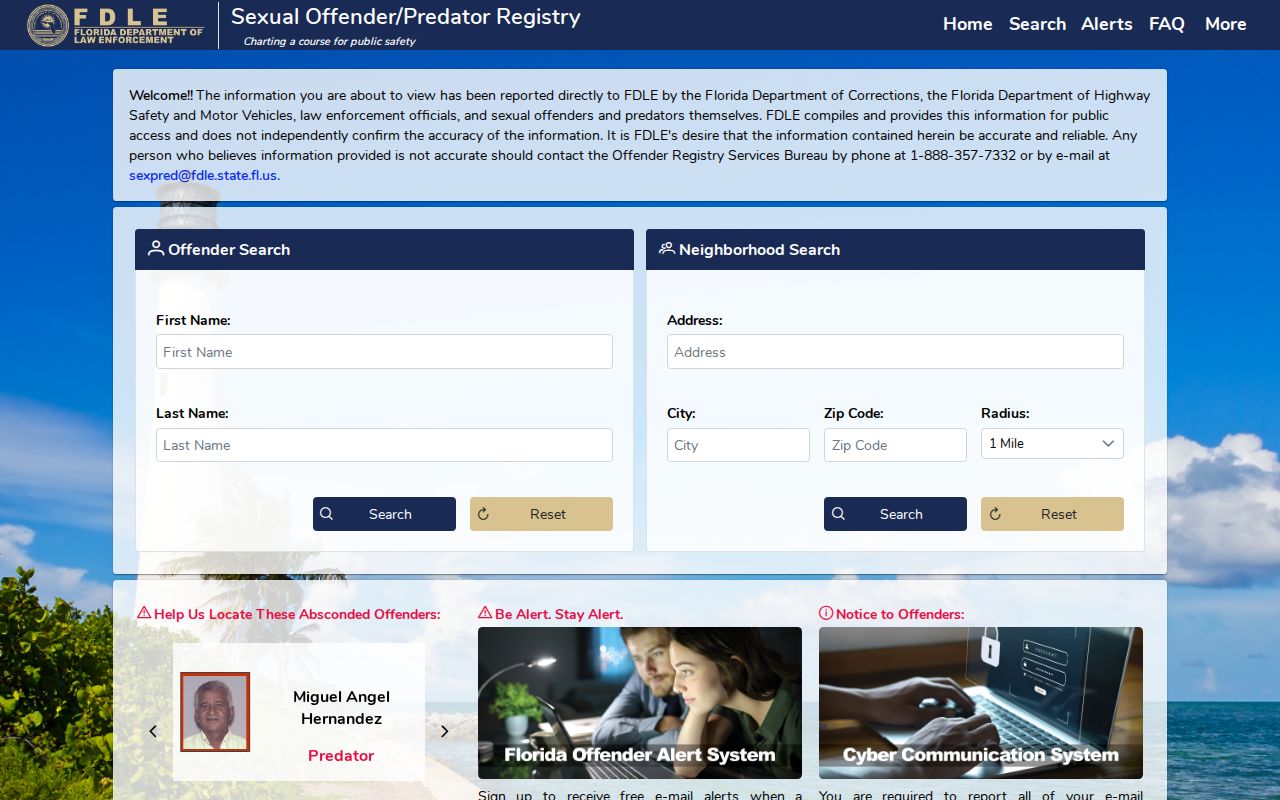
Read its notices and verify dates and status rather than inferring a household from one result.
Official Records Versus Compilations
Official sources show a custodian, date, legal purpose, and correction route. Commercial neighbor tools combine public, commercial, and user data. They may age quickly, merge people with the same name, or attach an old phone or address to the wrong person. Treat any commercial compilation only as a lead, never as proof.
| Choice | Strength | Limit |
|---|---|---|
| County map and roll | Current parcel provenance | Title is not occupancy |
| State voter record | Dated registration evidence | Protected and nonregistered residents absent |
| Association registry | Verified civic contact | No household roster |
| Commercial compilation | May suggest a lead | Stale or merged identities |
Privacy for St. Johns County Neighbors
Florida public access does not create a complete neighborhood roll. Address Confidentiality Program participants under sections 741.401-741.465 and people covered by exemptions in section 119.071 may have shielded details. Protected data is not proof that no record exists. Utility, delivery, and private membership data should not become public block lists.
Keep the search proportional to a lawful aim such as civic contact, reconnecting, historical research, or personal safety. Preserve dates, correct errors through the custodian, and do not publish sensitive details merely because one source displays them.
Lawful use. Use neighbor records to understand a block, reconnect, or support personal safety. Never watch, harass, intimidate, stalk, or harm another person.