
St. Johns County ZIP Areas
The 2020 Census relationship file identifies twelve ZIP Code Tabulation Areas, or ZCTAs, that overlap St. Johns County land or water. ZCTAs are Census approximations of mailing geography, not official postal boundaries. They are useful for countywide comparisons, while the U.S. Postal Service remains the authority for the delivery ZIP assigned to a specific address.
| ZIP Code | Areas Covered | Post Office | Notes |
|---|---|---|---|
| 32033 | Elkton, rural southwest and central county | Elkton mailing area | County overlap |
| 32080 | Anastasia Island and coastal south | St. Augustine mailing area | Mailing name exceeds city limits |
| 32081 | Nocatee area | Ponte Vedra mailing area | North county growth area |
| 32082 | Northeast coast | Ponte Vedra Beach mailing area | Coastal geography |
| 32084 | Historic and northwest St. Augustine, Vilano vicinity | St. Augustine mailing area | City and unincorporated areas |
| 32086 | South county and urban area | St. Augustine mailing area | Not all within city limits |
| 32092 | Western county and World Golf Village | St. Augustine mailing area | Large inland area |
| 32095 | North-central county and Palencia | St. Augustine mailing area | Unincorporated coverage |
| 32131 | East Palatka fringe | East Palatka mailing area | Cross-county geography |
| 32145 | Hastings and southwest county | Hastings mailing area | Southwest county |
| 32224 | Tiny northern fringe | Jacksonville mailing area | Crosses county geography |
| 32259 | Julington Creek and Saint Johns | Saint Johns mailing area | Northwest county |
The repeated St. Augustine mailing name is the main trap. Codes 32084, 32086, 32092, and 32095 cover materially different areas, and much of that land is outside the municipal boundary. Possible post-office or nongeographic codes were not confirmed in the research, so this ZIP code directory does not present them as active populated areas.
Verify St. Johns County ZIP Codes
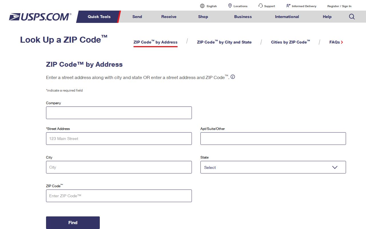
Use the official postal lookup when a full address is known. The USPS ZIP Code Lookup checks the delivery code tied to an address. That is a better authority for mail than a Census map, a directory listing, or a business record copied from an older filing.
| USPS input | Purpose | Practical note |
|---|---|---|
| Street address | Identifies the delivery location | Include unit details when applicable |
| City and state | Places the address in the postal system | The accepted city name may not equal the municipality |
| ZIP Code | Can confirm a code already supplied | Check it against the full address |
The official form shown below is the one successful ZIP image assigned to this page.
After USPS confirms delivery, use county GIS to decide whether the address is inside St. Johns County and which local district applies.
St. Augustine ZIP Geography
A St. Augustine line in a mailing address does not by itself place a parcel inside the City of St. Augustine. Four large ZIP areas use that mailing name while reaching historic city streets, Vilano, coastal neighborhoods, south county, World Golf Village, Palencia, and other unincorporated land. Jurisdiction should come from the county map and official city boundary, not the postal city line.
This distinction changes where records are kept. County property, recording, and court records stay with St. Johns County constitutional offices. City administrative records belong to the city that created them. For property and resident work, verify the parcel first, then choose the right custodian.
St. Johns County Fringe ZIPs
Two overlaps make the boundary issue easy to see. ZCTA 32224 carries a Jacksonville mailing name into a tiny northern fringe, while 32131 uses East Palatka and crosses county geography near the southwest edge. Neither mailing label should be treated as proof that the address lies outside St. Johns County.
The same caution works in reverse. A county-oriented data set may include only the portion of a ZCTA that overlaps St. Johns County, not every address with that ZIP. Statewide data, Census ZCTA totals, and local parcel totals therefore answer different questions.
Find St. Johns County Residents by ZIP
No documented Property Appraiser ZIP filter was found. A sound ZIP code directory workflow uses the GIS ZIP layer or free bulk data to define the area, then checks individual addresses and parcel records. VoteSJC verifies one voter, while a lawful statewide voter extract is delivered on physical media and must be handled with the required redactions. It is not a public web browse by ZIP.
- Confirm a full address and delivery code through USPS. Do not rely only on the city name printed in an old list.
- Open the St. Johns County Property Appraiser map and turn on its ZIP layer. Compare the address with parcel, city, and district boundaries.
- Use the parcel search or free CAMA and GIS downloads for owner, mailing, site, legal, and ZIP-related fields. Keep owner and occupant separate.
- For voter research, verify an individual with VoteSJC or follow the official state extract process. Remove protected fields and protected registrations.
Once the search reaches a named road, the St. Johns County street directory explains the address and parcel workflow in more depth. A ZIP code directory narrows geography; it does not supply a household list.
St. Johns County Parcel ZIP Clues
The Property Appraiser’s CAMA data distinguishes a site address from the owner’s tax-mailing address. It also includes parcel ID, owner name, legal description, values, use codes, building traits, sale history, and exemptions. A different mailing ZIP may point to an absentee owner, agent, or post-office box. It does not show that the owner lives at the mailing address or that anyone occupies the parcel.
The interactive map adds ZIP, zoning, school, evacuation, commissioner, aerial, and land-use layers. Search by address, parcel, or street, then click the parcel and nearby polygons. For a broad ZIP study, download CAMA or GIS data rather than claiming that the web property search has an unverified ZIP filter.
Access is not limited to the web map. The Property Appraiser publishes current and historical CAMA files plus GIS downloads at no charge, with a $10 CD option. Staff can help by phone at 904-827-5500, and GIS questions go to 904-827-5503 or GIS@sjcpa.gov. The public-record fallback is publicrecords@sjcpa.gov or 904-827-5541. At the office, 4030 Lewis Speedway, Suite 203, visitors may ask about parcel and map data on weekdays from 8:30 a.m. to 5 p.m.
St. Johns County Voter ZIP Data
Florida’s public voter fields generally include name, residence address, date of birth, party, phone, email, registration status, and participation history. Ballot choices are never included. Social Security numbers, driver-license or state-ID numbers, application source, copied signatures, preregistrants, and protected addresses stay closed.
The statewide active and inactive extract is requested at least 24 hours before its monthly availability and is supplied on physical media by mail or pickup, not emailed or browsed online. It can support lawful ZIP-level counts after exemptions are honored. Since participation updates can lag and inactive voters may remain eligible, attach the extract month to any count.
The county Supervisor of Elections remains the best contact for an individual registration and for correcting a county voter record. RegisterToVoteFlorida is an application and update service, not a public research tool. A full extract also includes only registered voters. It cannot account for unregistered adults, children, or every person who receives mail at an address.
Limits of a ZIP Directory
A postal code groups delivery points. It does not prove who lives at a home, who owns a parcel, or which government has jurisdiction. Census ZCTAs approximate ZIP geography for statistics. County GIS maps local boundaries. The postal service assigns delivery codes. These layers overlap, but they are not interchangeable.
Keep the source clear. Label results as USPS delivery data, Census ZCTA geography, or St. Johns County parcel data rather than calling all three a ZIP boundary.
Protected voters, renters, children, informal household members, and recent movers may not appear in official name-based rolls. Use ZIP findings for geography and then verify any person through a dated, relevant record.
Florida’s public-record law can fill a narrow gap when a published data file does not contain the needed field. Ask for an existing electronic record series concerning a named area and date range, excluding exempt information. A custodian may charge for copies or extensive staff work, so request an estimate first. The law provides access to existing records; it does not require an agency to build a new ZIP analysis.
St. Johns County ZIP Boundaries
The safest sequence is delivery code, parcel, then jurisdiction. USPS resolves the address used for mail. The Property Appraiser map locates the parcel within St. Johns County and shows local layers. A municipal boundary check then tells which city may hold administrative records. This prevents a St. Augustine, Jacksonville, or East Palatka mailing name from sending a public-record request to the wrong office.
- ZIP and ZIP+4
- A five-digit delivery area and its more exact four-digit segment.
- PO-box ZIP
- A code used mainly or only for post-office boxes. Possible local codes require USPS confirmation.
- Unique ZIP
- A code assigned to one high-volume organization rather than a broad neighborhood.
- Carrier route
- A group of delivery points served in one postal route.
When sources disagree, record the date of each and confirm the current mailing code with USPS. Then use the county office that owns the record, not the mailing name, for the next search.